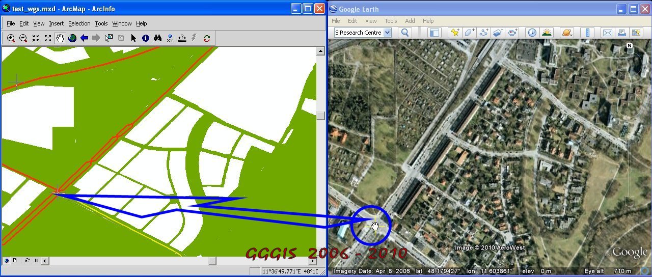
SyncNavigation 2.0
Fig.1: Pan or Zoom in ArcMap
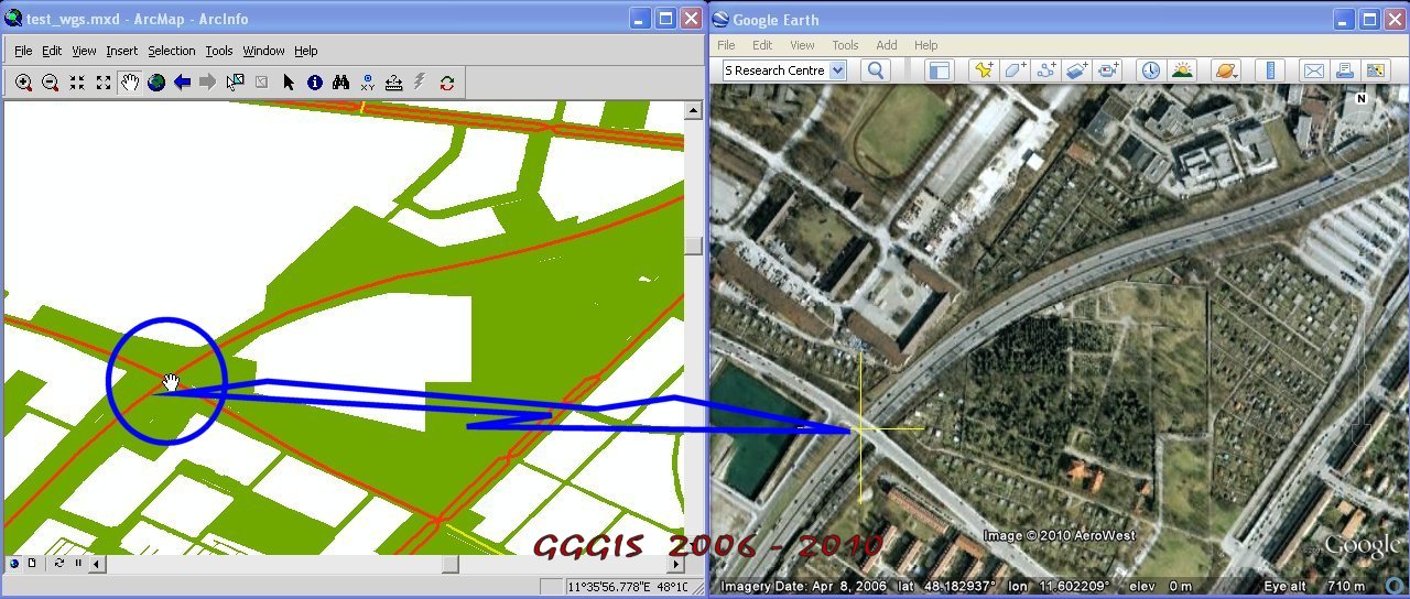
Fig.2: Pan or Zoom in Google Earth
SyncSelection 1.5
Featuress:
- Select a feature (point, polyline or polygon) in ArcMap (shape file), the feature with attributes will be highlighted in ArcMap and in Google Earth synchronally;
- Select a object in aerial image of Google Earth, the object with attributes will be highlighted in Google Earth and in ArcMap synchronally;
- Mouse cursors are displayed synchronally in ArcMap and Google Earth (for location tracking );
- It's compatible with SynchronizingAG, i.e. SyncSelectionAG 1.5 contains the functionalities of SynchronizingAG 1.6.
Fig.1: Select a polygon in ArcMap
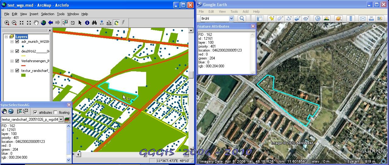
Fig.2: Select a polygon in Google Earth
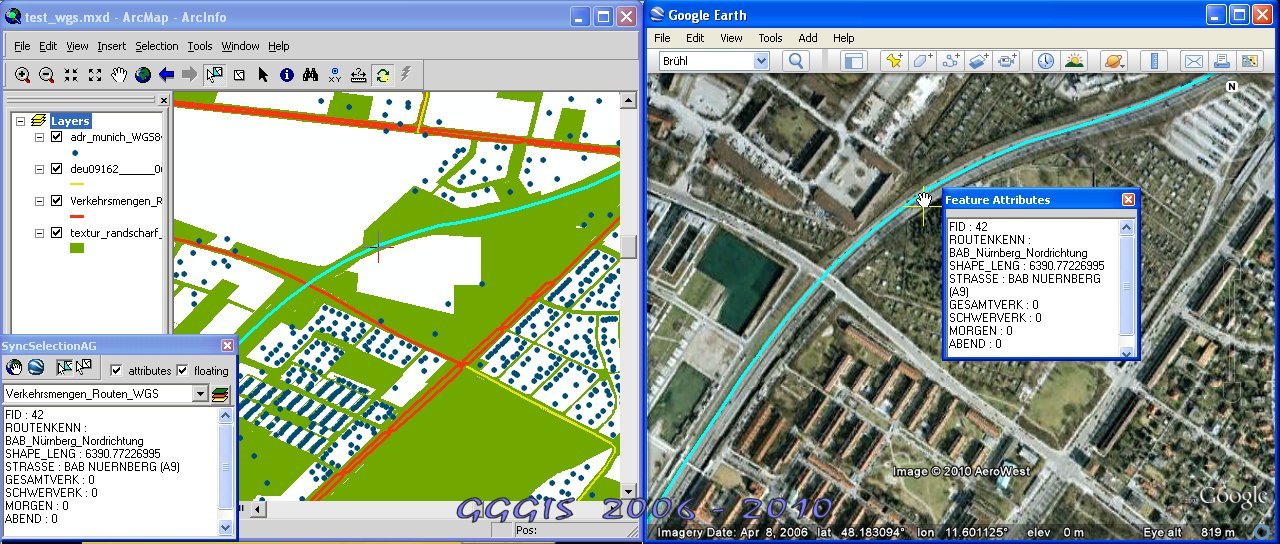
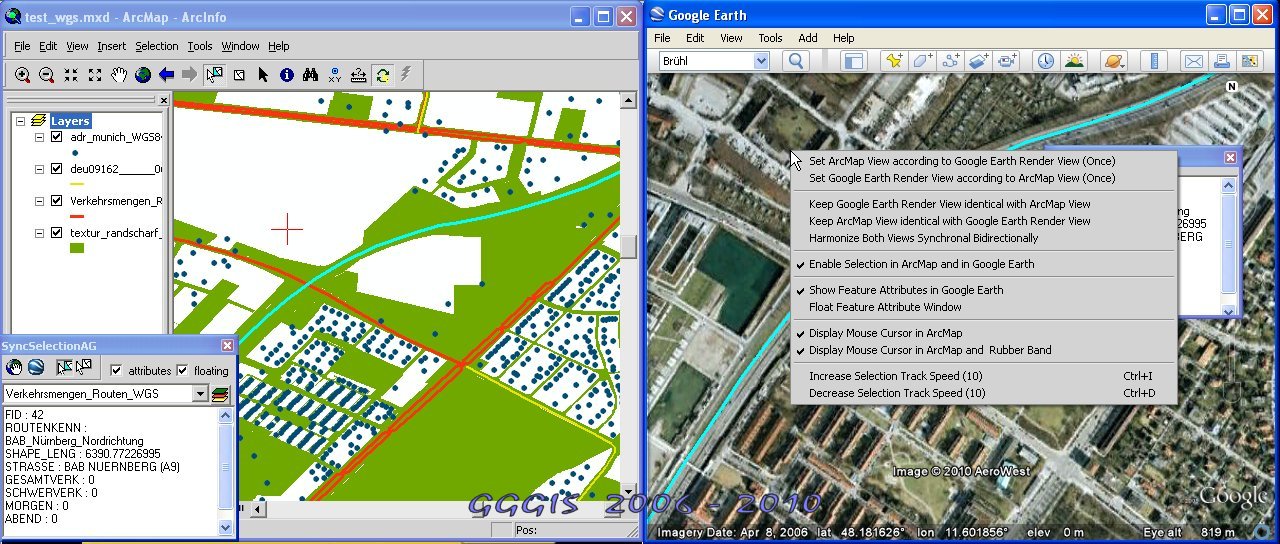
Fig.3: Context Menu for Selection Options
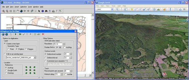
GEDigitizer 2.1
[Continue...]
Copyright© Googlizing, Gislizing® 2006-2010. All rights reserved.
Verantwortlich für den Inhalt dieser Seite ist ausschließlich der Autor dieser Homepage. Missbrauch melden