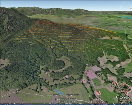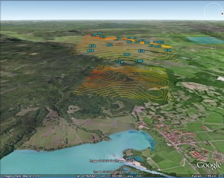
Create Contours for Google Earth in real time V1.5In this version, you are able to save new created contours into 2D KML und 3D KML (Keyhole Markup Language).
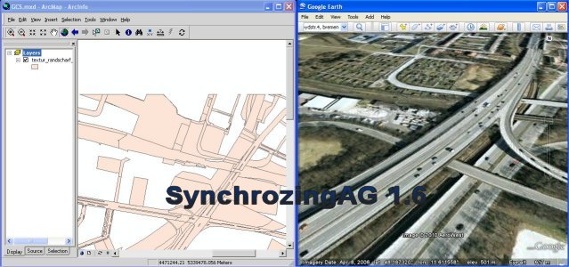
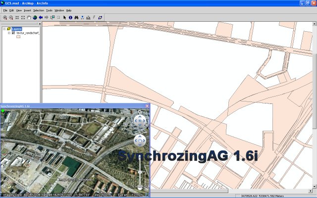
SynchronizingAG 1.6 / 1.6iNew Features: - Support Google Earth perspective view (bird's-eye) - Match to new versions of Google Earth
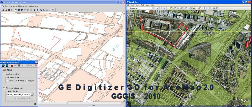
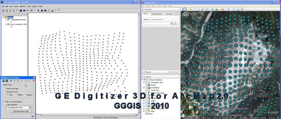
GEDigitizer 2.0The main funtions: - Digitize Features on Google Earth and import into ArcMap synchronally; - Export existing layers from ArcMap into Google Earth dynamically; - Get elevation points from Google Earth and import into AcrMap in real time; - Build contours automatically. Fig. 01: Digitize a Polyline
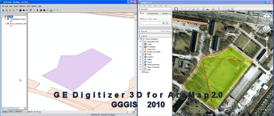
Fig. 02: Digitize a Polygon
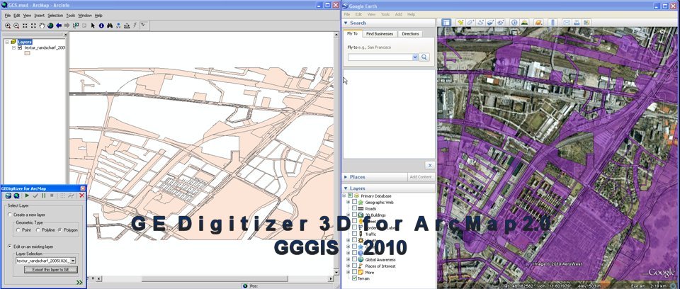
Fig. 03: Export a existing layer of ArcMap into Google Earth
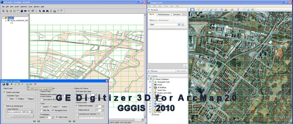
Fig. 04: Options for Import of DEM points from Google Earth into ArcMap
Fig. 05: Import DEM points from Google Earth into ArcMap
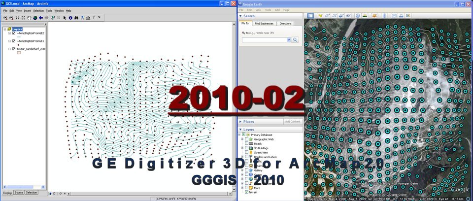
Fig. 06: Import Contours from Google Earth into ArcMap
Copyright© Googlizing, Gislizing® 2006-2010. All rights reserved.
Kostenlose Website erstellt mit Web-Gear Verantwortlich für den Inhalt dieser Seite ist ausschließlich der Autor dieser Homepage. Missbrauch melden |